NASA
LANDSAT Pathfinder Project
The LANDSAT Pathfinder Project Operation was driven by science goals of
land cover change detection, global carbon cycle and biogeochemistry,
but also encompassed data management activities that form part of Earth
Observing System/Data Information System version 0, IGBP DIS and international
forest management programs.
The Kioloa GLCTS Pathfinder Site
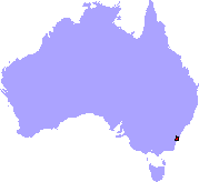
Kioloa was one of four Australian Global Land Cover Pathfinder sites
nominated. It is the only one which has been completed. Kioloa is situated
in South Eastern New South Wales. It is the global type site for Eucalypt
forest. This site was developed and made available by Prof Brian Lees
and his students when he was at the School
of Resources, Environment and Society at the Australian
National University, Canberra, Australia in 1997.
Corrections and additions are added as necessary.
The Pathfinder site includes the whole catchment of the Clyde River,
adjacent coastal areas, the southern limit of the Sydney Basin, and
two important wetlands - the Clyde River / Cullendulla Creek estuaries
and St. Georges Basin. The area covers three main types of landform;
a coastal lowland, a hill belt, and a mountain belt. The coastal plain
is the most complex belt and consists of rolling and undulating country
with restricted plains. The coast itself is characterised by long sandy
bays interspersed by sections of rugged cliff. There are a great many
estuarine lagoons formed by barrier beaches across the mouths of drowned
river valleys. There are some limited areas of igneous rock intrusion
but the area is largely sedimentary (Ordovician and Permian). The hill
belt is made up of dissected forested hills on folded (Ordovician) sedimentary
rocks. Altitudes rarely exceed 300m. The mountain belt consists of steep,
rugged, dissected plateaux in (Permian) sedimentary rock. Rivers here
flow in deep, narrow valleys with some steep cliffs. There are some
limited areas of basalt.
The predominant vegetation of the area is sclerophyll open-forest within
which 68 communities have been recognised. The other communities are
treated as components in various community complexes. The riverine forests
which contain a sclerophyll component and rain forest lack a particularly
clear set of environmental conditions and constitute an intermediate
category.
Broadly the sclerophyll forests can be considered in three categories.
The coastal forests are distinguished by Eucalyptus gummifera
on 'poorer' sites and E. maculata on more mesic situations. The
upland forests are distinguished by E. fastigata and E. mullerana
and occur above about 250m. Other community complexes of significance
in the area are the dune sere, the estuarine communities, particularly
those with mangroves and Allocasuarina glauca, a variety of freshwater
and brackish swamps, and heath vegetation on the Permian sandstones
in the north. The riverine forests are composed predominantly of eucalypts
but frequently the rain forests behave as gallery forests and monospecific
stands of Backhousia myrtifolia may occur on the banks of narrow
streams.
Land use in the area ranges from active forestry operations, national
parks, agriculture (particularly on the coastal plain) to urban. The
towns of Ulladulla and Milton are in the central part of the dataset.
The Australian National University has its KIOLOA
field station in the area and a smaller field station, The Edge,
immediately adjacent to the western boundary of the area. The area
is
within easy driving distance of both Canberra and Sydney. There are
a large number of papers and theses published
on aspects of the area. It is an area of continuing research activity.
The Pathfinder dataset includes a Digital Elevation
Model, Geology, Land
Systems, Multi-date Landsat TM, JERS OPS and SAR imagery and
Various Climatic Data for the area. Contact Brian
Lees,
site PI, to obtain access to the image data. There
is also now a CSIRO
EOC site at Kioloa.
Detailed field data exists from surveys by Russell-Smith
(1979), Davey (1989) and Van Neil (2003). The documentation file
lx3030n.txt lists corrections to the original lx3030 file (derived from
Davey's SMD30 dataset) made by Van Neil over 2000-2003. Both are
included in the documentation.
Available Datasets
|