Location of Study Area
The Injune Landscape Study Site is a 220,000ha area located near the town of Injune, within the southern Brigalow Belt in central Queensland, Australia.
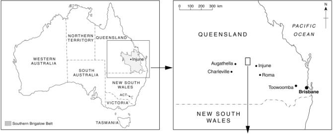
Regional location of the Injune study site.
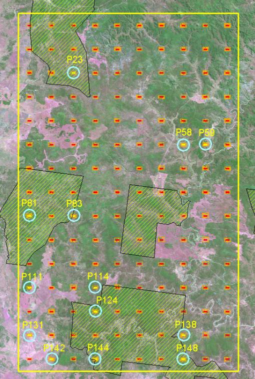
The image below shows the the study area with a Landsat
satellite image from 2000, showing the sampling grid <link for close up> and
the location of the Primary Sampling Units that contain the field plots
(circled in blue). The diagonal hashed
areas are State Forest tenure. In the
image, the green areas are forest or woodland, and the pink areas are cleared
or contain forest regrowth.
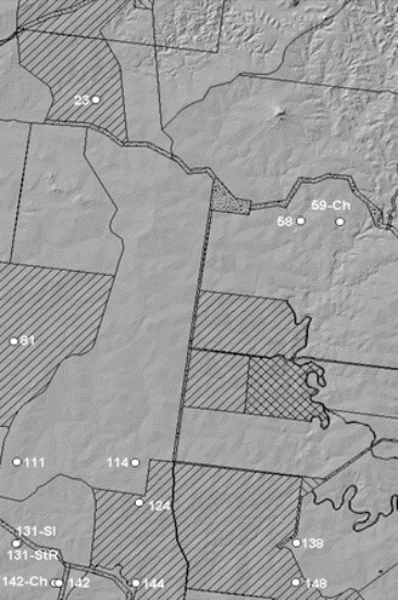
The following image shows the study area using a
hillshaded view of a 3D ground model.
Most of the area is reasonably flat, as shown by the relative lack of ‘shaded’
hills. Also shown are property boundaries - diagonal lines are State Forest
areas, cross-hatch is freehold, and the rest of the area is leasehold. The field plots are shown as white circles.